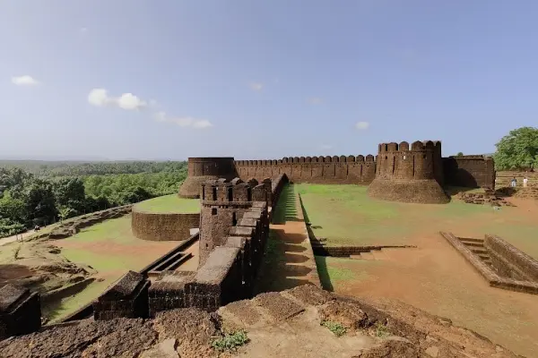
Mirjan Fort, often called the “Queen Chennabhairadevi’s Fort,” dates back to the 16th century and stands as a proud relic of the pepper trade era under the rule of the “Pepper Queen” of Gersoppa. Sprawling over 10 acres, the fort’s four main entrances, moats, and hidden escape routes showcase the strategic brilliance of its design. Built with reddish laterite stones, the fort walls blend naturally with the surrounding landscape, especially during the monsoon when the area turns vividly green.
Inside the fort, remnants of old wells, watchtowers, and an internal drainage system can still be seen — a testament to the region’s medieval engineering prowess. The Archaeological Survey of India (ASI) maintains the site today, making it one of the most photogenic and peaceful historic sites along the coastal belt of Karnataka.
| Location | Google Maps |
|---|
| By Type | Fort |
|---|
⚠️ This content may be AI-generated and could contain misinformation. If you notice any issue or want to suggest edits, please let us know.