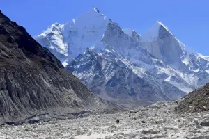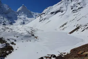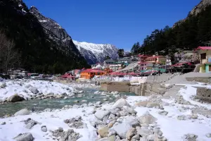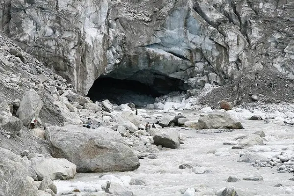
Gaumukh is the source of the Bhagirathi River, one of the primary headstreams of the Ganges. It is located at an altitude of around 4,000 meters in the Uttarkashi district of Uttarakhand, near the Gangotri Glacier. The name "Gaumukh" means "cow's mouth" in Sanskrit, derived from the shape of the ice formation that resembles a cow's snout. It is a revered pilgrimage site for Hindus and a popular trekking destination for adventure seekers.
Gaumukh holds immense religious importance as it is considered the origin of the holy Ganges. According to Hindu mythology, King Bhagirath meditated here to bring the river Ganga down from heaven to purify the ashes of his ancestors. The river, believed to have descended from Lord Shiva’s locks, is worshipped by devotees who visit the site for spiritual cleansing.
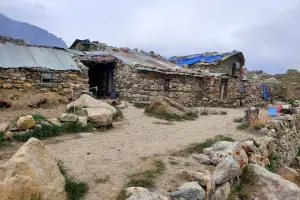
Reaching Gaumukh requires a trek of approximately 18 kilometers from Gangotri, passing through scenic landscapes, rugged terrains, and glacial moraines. The trek passes through Chirbasa and Bhojbasa, which serve as resting points for trekkers. Permits from the forest department are required to undertake the trek due to its location within the Gangotri National Park.
Peak Season: May–June and September–October (before heavy snowfall).
Low Season: November–April (inaccessible due to snow).
Crowd Type: Mix of pilgrims, trekkers, and nature lovers.
Acclimatize properly in Gangotri before starting the trek to avoid altitude sickness.
Start the trek early in the morning to ensure a safe return before evening.
Carry sufficient water, food, and warm clothing as weather conditions can change rapidly.
Trek with a guide or in groups, as the trail is challenging and remote.
From Gangotri: The trek to Gaumukh starts from Gangotri, covering around 18 km.
Trekking Route: Gangotri → Chirbasa (9 km) → Bhojbasa (5 km) → Gaumukh (4 km).
Transport Availability: No public transport; trekking is the only way to reach Gaumukh.
| Location | Google Maps |
|---|
| Entry Permit | Required from Gangotri National Park Office |
| Trek Distance | Approx. 18 km one way |
| Difficulty Level | Moderate to Difficult |
| Best Season | May–June, September–October |
| Accommodation | Limited options at Bhojbasa (GMVN guest houses, ashrams, tents) |
| Altitude | Approx. 4,000 meters |
| Nearest Major Town | Uttarkashi (100+ km) |
| By Type | Glacier , Religious Site |
|---|
⚠️ This content may be AI-generated and could contain misinformation. If you notice any issue or want to suggest edits, please let us know.